FishersNavi Pro
You can easily check the ocean data whenever you need
Features
- You can use FishersNavi Pro using your own tablet or PC.
- Semi-real time data update. Almost every hour update the latest data.
- Sea level anomaly data and Chlorophyll data are available.
- Smooth screen transition.
Data items
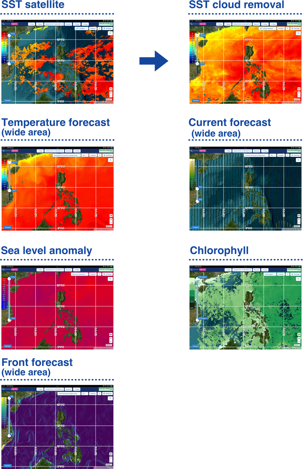
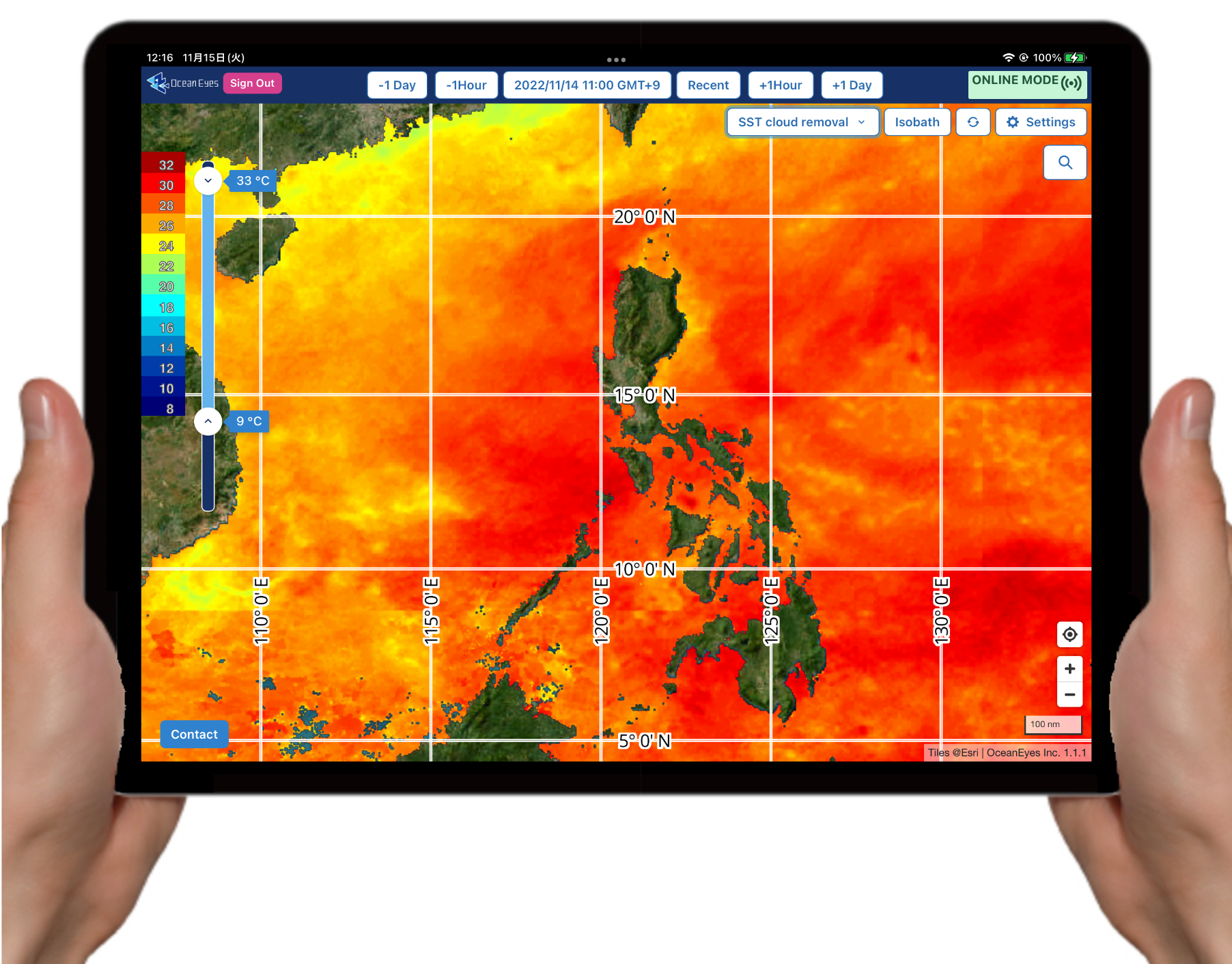
- SST satellite is sea surface temperature data calculated from weather satellite Himawari observation data.
- SST cloud removal is SST satellite data complemented the cloud covered area by using the OceanEyes original image reconstruction technique of the deep learning system.
- Temperature forecast and Current forecast are marine environments forecast using numerical ocean models. Wide area data and Japan coast data are available.
- Temperature forecast, Current forecast and Oceanic front forecast have 0m, 10m*, 30m*, 50m, 100m, 150m, 200m depth data(*only wide area).
Please check the Technical Overview page for the details.
Contact
If you have any inquiries about FishersNavi Pro such as subscription fee, service data area and so on, please contact us on the e-mail address below.
info@oceaneyes.co.jp